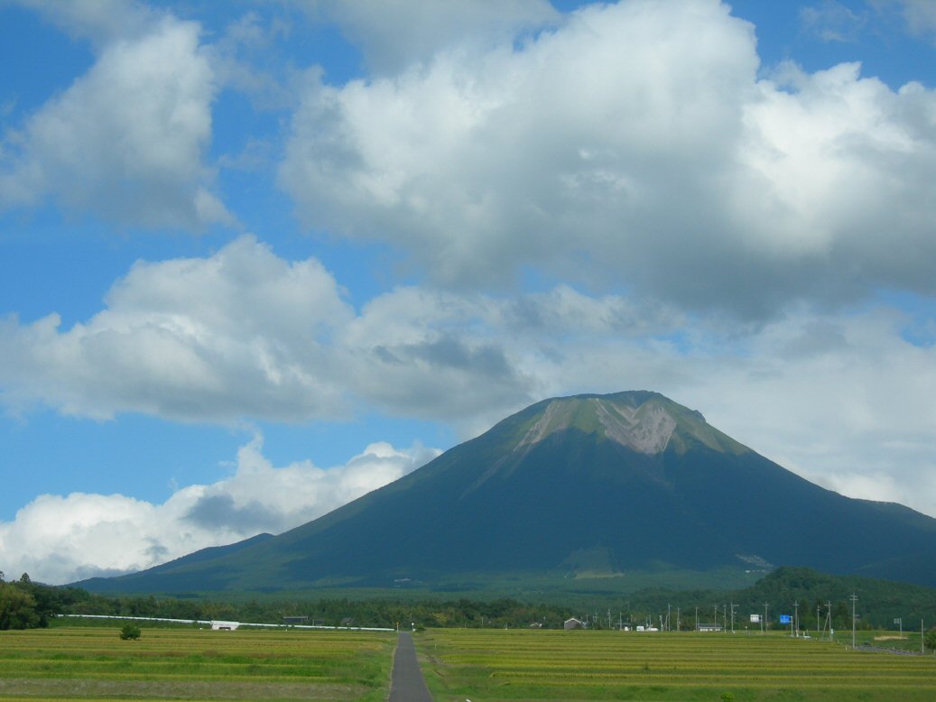
High grassy basin ringed by three mountains on the Daisen ring road, a serene meadow lookout and hiking base.
Kagamiganaru is a wide, high grassy basin cradled among the peaks on the southern reaches of the Daisen massif, at around 900 metres above sea level. Its name means roughly "the mirror plain," and the flat, meadow-floored bowl is enclosed by three mountains, Mt. Kofu (Zozan), Mt. Sengan (Karasugasen) and neighbouring summits, that rise around it like the rim of a natural amphitheatre. The effect is calm and spacious, a green clearing in the heart of the Daisen-Oki National Park where the surrounding forest opens to sky.
The highland works both as a viewpoint in its own right and as a gateway to bigger views. Standing in the basin, you are ringed by wooded and grassy peaks whose slopes turn brilliant with colour in autumn, and the open meadow makes an easy, pleasant place to walk, picnic or simply take in the mountain air. For a broader panorama, trails climb from the basin onto the encircling summits; the ascent of Mt. Sengan (Karasugasen) begins here, and even a short climb up its flank rewards you with a sweeping look back down over the whole grassy bowl and out toward the ranges of southern Tottori.
Because it sits at altitude, Kagamiganaru stays cool and green through summer while the lowlands swelter, and it is a popular base for hiking, camping and nature study. There is a rest house, a campground and public restrooms, and in winter the slopes host a modest ski area, so the site is used year-round, though the road access is affected by snow in the cold months. Autumn is the visual highlight, when the beech and mixed woodland on the surrounding peaks blaze into koyo colour and the contrast of golden slopes against the meadow and sky is at its best.
The basin lies in Kofu Town in the Hino District of southern Tottori, on the scenic ring road that loops around Mt. Daisen and links a string of viewpoints. This makes it a natural companion to the nearby Kagikake Pass, and many visitors drive the two together along with the western Masumizu Highland to sample Daisen's contrasting faces, rugged south wall, Fuji-like west, and quiet upland meadows, in one outing.
Access is realistically by car. From JR Yonago Station it is around a fifty-minute drive up the Daisen roads into the highland, where free parking sits beside the rest house and campground. There is no regular year-round public transport to the basin, but during the autumn foliage season the seasonal Daisen Loop Bus stops at Kagamiganaru on weekends and holidays, giving car-free travellers a way to reach it at the prettiest time of year; confirm the timetable before you go. Because the road climbs high and can close with snow, plan visits for late spring through late autumn, and bring warm layers even in summer, as evenings on the plain turn cool quickly once the sun drops behind the peaks.
A local's tip
The short trail up Mt. Sengan (Karasugasen) starts right here; even a little way up the slope opens a wide view back across the grassy bowl ringed by three peaks.
Best time to visit
Autumn for the surrounding foliage, or summer for cool green meadows
Getting there
From JR Yonago Station drive about 50 minutes up the Daisen ring road to the Kagamiganaru basin; there is no year-round bus, though the seasonal autumn Daisen Loop Bus stops here. Free parking is available by the rest house and campground.
Good to know
- Parking
- Restrooms
- Campground
Plan the whole trip offline
Kagamiganaru Highland is one of many places in the Real Japan app — with turn-by-turn directions, nearby spots and full offline maps you can use with no signal.